IBW Surveyors
Ivan B. Wallace O.L.S. Ltd. was incorporated in 1991, but it actually dates back to 1950 when Graydon T. Horton opened his practice in Ajax, Ontario. The firm that eventually became Horton, Wallace and Davies in 1980 after several incarnations such as, G.T. Horton and Associates, Horton, Carr and Haynes, Horton & Haynes, and Horton & Wallace.
The various office’s of Horton, Wallace & Davies each became independent in 1990 as the Cobourg and Quinte offices were sold to their managers and finally, the Bowmanville office became Ivan B. Wallace O.L.S. Ltd. in 1991.
Ivan B. Wallace O.L.S. Ltd. spent the next few decades rebuilding and acquiring firms along the Highway 401 corridor, once again entering into the Cobourg an Quinte offices with an additional focus on providing quality surveys from Toronto right through to the Quebec border.
In 2022, Ertl Surveyors of Richmond Hill strategically merged their operations with Ivan B. Wallace OLS Ltd, prompting a name change to what is now known as IBW Surveyors Ltd. This merger officially took place on March 1, 2022, making IBW Surveyors Ltd. one of the largest land surveying firms in Ontario.
IBW Surveyors Ltd. is now working hard to build a great company that lasts forever, and a firm that is focused on providing Professional Land Surveying services across Ontario to Property owners, professionals (engineers, architects, planners), developers, and contractors who value professionalism and quality service over price.
We have three uniques that enable us to be the best at what we do:
Our People
We hire the best people and train them to be the best at what they do.We hire, fire, train and reward our people based on the following core values:
- Keen learners seeking opportunities to grow
- Confident yet humble
- Caring and compassionate towards our colleagues and our clients
- Committed to a team culture
Responsive, Reliable Advice
We respond quickly and reliably to clients.
Capacity To Get Things Done
We have the ability to dedicate resources to get projects done on time, big or small.

We are a proud member of the Bowmanville Rotary Club, and take pride in contributing to the fundraising efforts that support Rotary’s philanthropic endeavours within our local community and across the globe.
THE HISTORY OF IBW SURVEYORS
1990
- Ivan B. Wallace Ontario Land Surveyor Ltd was established in Bowmanville, Ontario.
- IBW acquires T.S. Fluke (Peterborough) O.L.S. records.
- IBW acquires Culham Wallace & Davies O.L.S. records.
- IBW acquires Donevan & Richards O.L.S. (Cobourg) records.
2000
- IBW acquires Culham Surveying records IBW acquires Brown & Coggan O.L.S. Ltd. and opens Cobourg Branch Office.
- IBW acquires Kerry Boehme O.L.S. Ltd. and opens Trenton Branch Office.
2010
- IBW acquires J. Vinklers Surveying Ltd.
- IBW opens Toronto Branch Office as Vinklers, Wallace & Ertl O.L.S. Ltd.
- IBW opens Peterborough Branch Office.
- IBW acquires B. Roger Pickard Surveying Ltd. and opens Picton Branch Office.
- IBW amalgamates the Trenton and Picton offices to form one central office in Belleville.
2012
- IBW acquires 43 Degrees North.
2013
- IBW acquires Wayne R. Wollerman.
2014
- IBW amalgamates the Peterborough and Cobourg offices into the Head Office in Bowmanville.
- IBW acquires Coutts and Flim.
2018
- IBW Acquires Smith and Smith Kingston Ltd. Ontario Land Surveyors.
2020
- IBW acquires Tony Staukas Surveying Inc. in Mississauga, Ontario.
2021
- IBW Acquires Meldrum Surveying in Cornwall, Ontario.
- IBW Acquires Ron M. Jason Surveying in Prescott & Alexandria, Ontario.
- IBW Acquires L.U. Maughan Surveyors Ltd in Parry Sound, Ontario.
2022
- IBW Merges with Ertl Surveyors Ltd
- The merger also brings Hunt Surveys Inc to IBW
- Acquires K.L. Stidwill O.L.S. Ltd. in Cornwall, Ontario
- Acquires Omari Mwinyi Surveying in Pickering, Ontario
2023
- Acquires E.R. Garden Surveying Ltd.in Newmarket, Ontario
Ivan B. Wallace O.L.S Ltd. is in possession of the following Ontario Land Surveyor Records:
43° North
A.V. Flim
B. Roger Pickard/Hume Pickard
Brown & Coggan
C.F. Riley
Campbell Taylor Smith (541)
Charles Henry Donnelly (1066)
Coutts & Flim
Culham Surveying
Culham, Wallace & Davies
Don Trollope
Donald Campbell Smith (681)
Donevan & Richards (Cobourg)
Doug Coggan
Ertl Surveyors Ltd.
E.R. Garden Surveying Ltd.
Frank Delph
Friel & Boehme
Friel, Boehme & Hume
G.L. Parker
H. Flim
Hazen Meldrum, O.L.S. Ltd. (959)
Horton, Wallace & Davies
Hunt Surveys Inc.
Keith F. Lashley
Kerry Boehme
Kim Clement
K.L. Stidwill O.L.S. Ltd.
L.U. Maughan Surveyors Ltd
M.D. Brown
Meldrum Surveying Ltd. (959)
N.E. Friel
Omari Mwinyi Surveying
Ron M. Jason Surveying
Sidney John Glenn Bird
Smith & Smith Kingston Ltd. (SS)
T.S. Fluke
Tony Stauskas Surveying Inc. (1672)
William Lindsay Malcolm (446)
W.R. Brick
Wayne Wollerman
OUR MISSION
Provide outstanding service across the board by developing and building the strongest team in the industry.
Our Industry Partners


We Use Cutting Edge Equipment & Software
to Deliver You the Most Accurate Results
Equipment

Trimble Robotic Total Stations
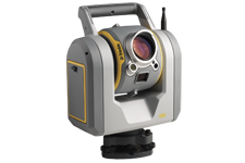
Trimble SX10

Trimble GNSS Systems
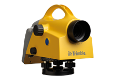
Trimble DiNi Digital Level

FARO Focus3D X 330
Software

AutoCAD® Civil 3D®

Bentley MicroStation

MicroSurvey CAD

Trimble Business Center

MicroSurvey STAR*NET

Autodesk ReCap 360 PRO

Pointsense PRO & VirtuSurv