LiDAR - 3D LASER SCANNING
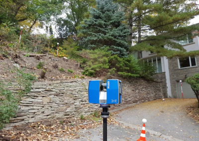
Start Your Project3D Laser Scanning, also known as LiDAR (Light Detection and Ranging) and HDS (High Definition Surveying), is a very precise and accurate method of collecting millions of points over a short range of time for either very complex or simple environments.
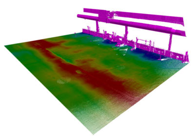
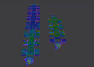
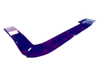
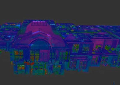
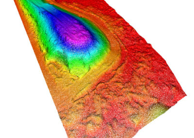
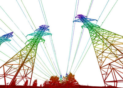
The scanner records the horizontal (x and y) and vertical (z) position of the surveyed points, as well as the intensity that is reflected by these points. RGB (Red, Green, Blue) values which are known as ‘True Color’ can also be recorded, providing an accurate 3D representation of reality.
The scanner is setup at multiple locations, capturing all the data that is within its line of sight. The data is then combined as a Point Cloud in the office. Any 3D information (linework, points, etc.) can be extracted from the Point Cloud and generate all types of CAD drawings.
At IBW, we use our highly skilled team of surveyors, combining traditional surveying techniques with 3D laser scanning to achieve the best of both worlds.
Advantages
Precision
High definition, high accuracy and high speed – dense point cloud, high level of detail.
Clash Detection
Verify if there is conflict between point cloud and model elements in pre-construction phase, avoiding future costs and time delays.
Collaboration
Point cloud can be shared with clients, consultants, and any personnel involved in the project. Files can be easily accessed using a web browser interface.
Efficiency
Reduces number of site visits and future work. Millions of accurate surveyed points are collected over shorter time.
Safety
Roads, bridges, and other high-risk sites can be safely captured without any contact.
Versatility
Measurements can be taken off the cloud, saved as an annotation and used as markups for personnel with access to the point cloud.
Applications
Detailed Topographic Surveys
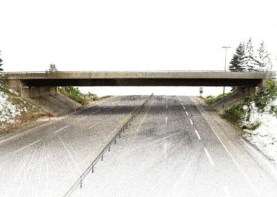
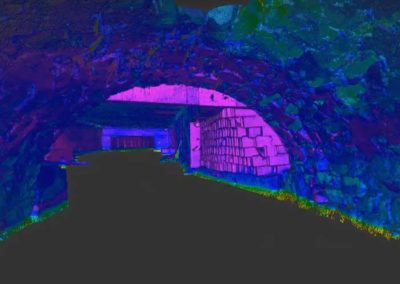
Roads, Bridges & Tunnels
As-Built Surveys
Engineering Surveys
Building Surveys – Indoor & Outdoor
Pre-Construction & Monitoring Surveys
Site Development & Planning
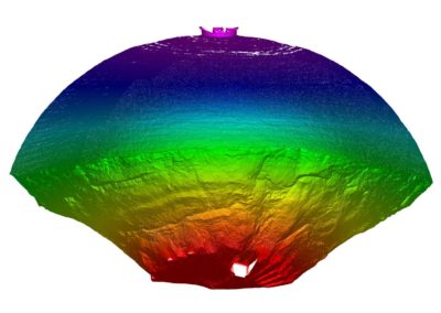
Volume Surveys
Post Construction Surveys
Event Pre-Planning – Layout of Site Conditions
Deliverables
2D & 3D CAD Drawings
High Definition Images
Point Cloud – Import Your Point Cloud into AutoCAD
360° Panoramic Image
Web App – Access Your Point Cloud Online
Floor Plan, Cross Sections, Profiles
Digital Terrain Model (DTM) – 3D Surface
Fly-Through the Point Cloud – Animated Visualisation
Orthoimage
3D Laser Scanning Projects
Frequently Asked Questions
What deliverables can we expect when we use 3D LiDAR scanning?
The main deliverable for 3D LiDAR scanning is a point cloud. Another common deliverables are dwg drawings containing 3D linework and 3D points.
Do we need light when scanning?
No light is needed when scanning. Measurements can still be taken without light. However, light is still important for picture quality.
Is 3D scanning less accurate than a traditional survey?
3D laser scanning is a highly accurate method of measuring a project. In most cases, traditional methods of surveying are applied with 3D LiDAR scanning to transform the point cloud to the project-required coordinate system.