Above Ground & Underground Topographic Survey
Project Overview
This project was a great combination of traditional surveying techniques and laser scanning.
Identify All Visible Topographic Features Above Ground and Underground
Generate Surface Model
Create Tunnel Profile – Floor and Ceiling
Establish Boundary Limits
Identify the Existence of any Easements and Right of Ways or Other Potential Title Issues that may Affect Design
Coordinate and Map Underground Utility Locate
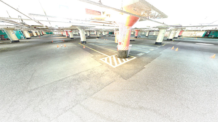
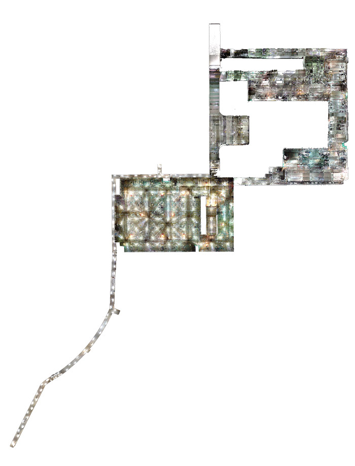
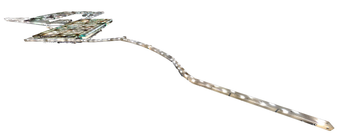
Images obtained from 3D point cloud.